


Product Details
Capture precise digital models of assets, infrastructure, and environments with the Emlid Pix4D and Emlid Mobile Scanning Kit . This all-in-one package includes everything you need to get started - from the Emlid Reach RX RTK rover to the essential accessories. Designed for professionals across multiple industries, this plug-and-play solution integrates advanced photogrammetry with RTK precision, allowing you to capture accurate 3D models directly from your smartphone using the user-friendly PIX4Dcatch app .
Note : A separate PIX4D software license is required, which is available for purchase on our store.
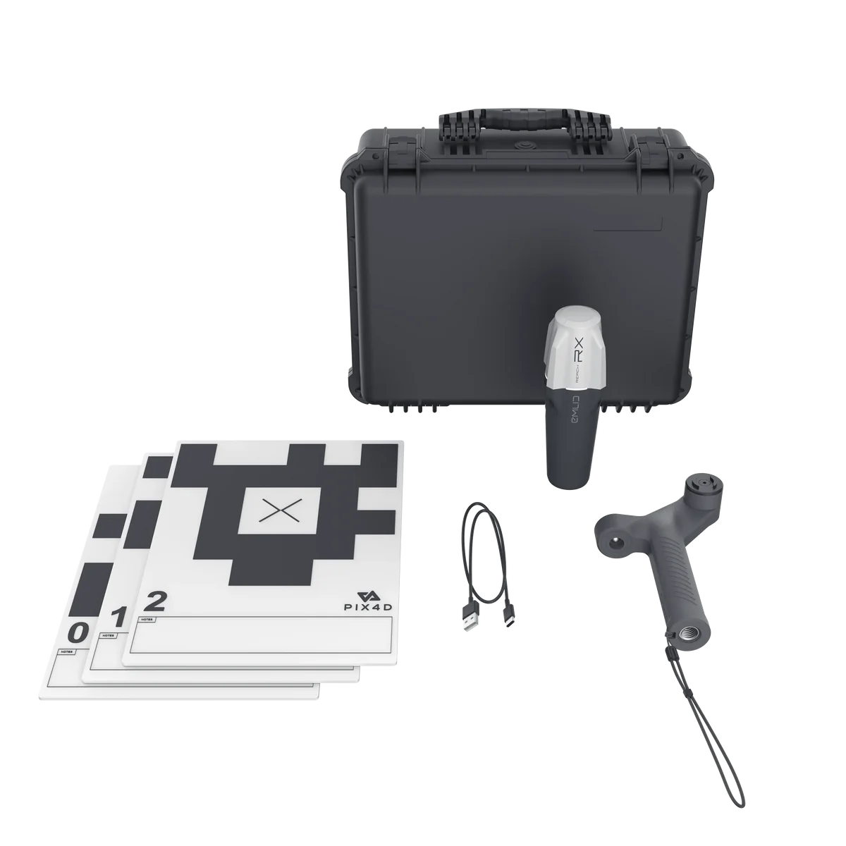
What's in the Kit?
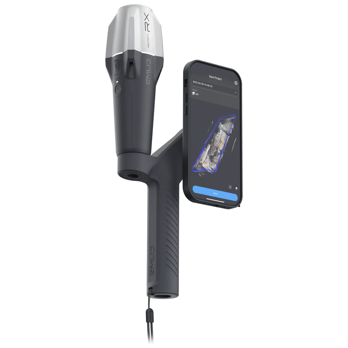
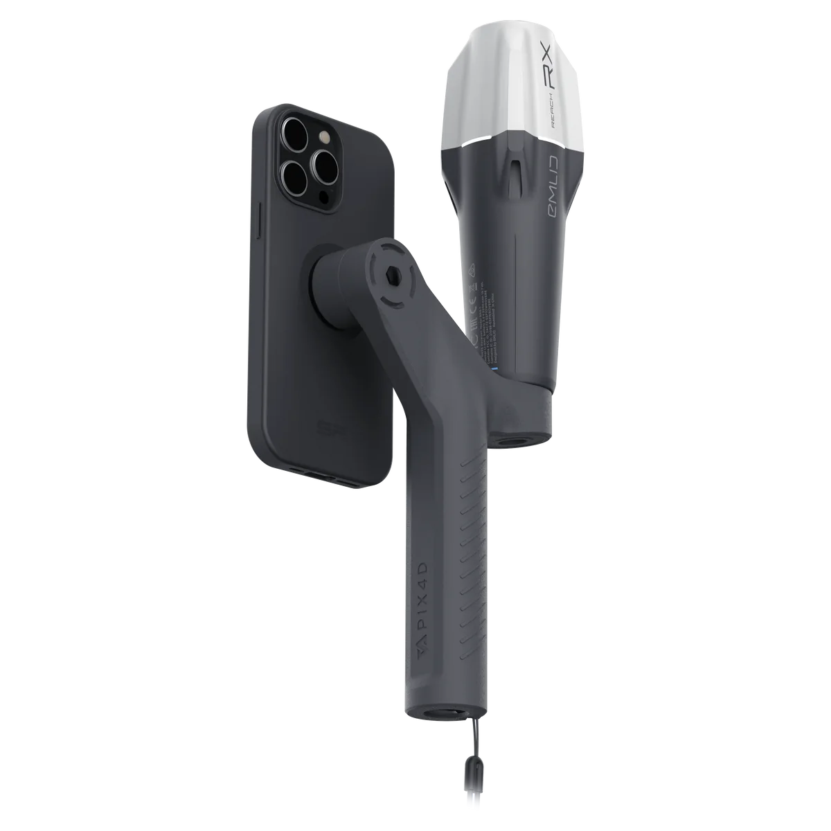
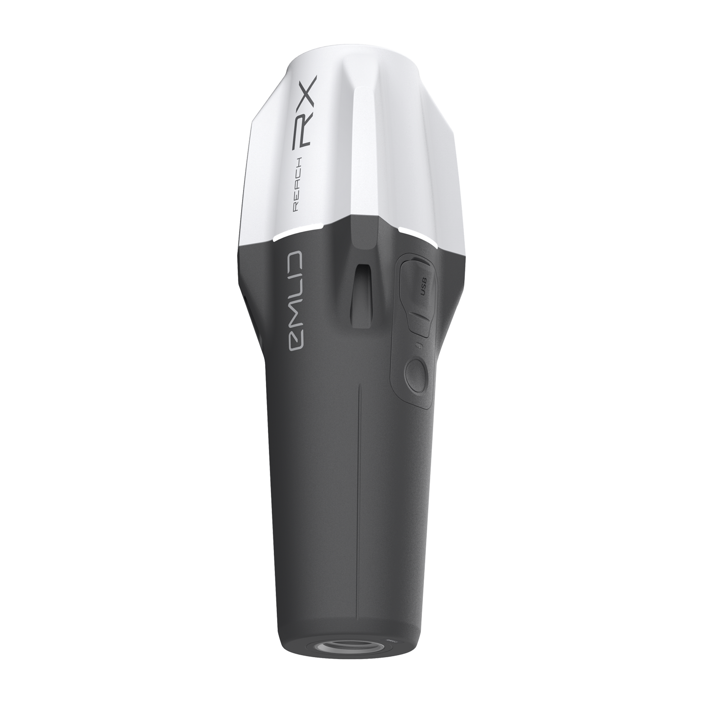
- Emlid Reach RX RTK Rover : A compact, high-precision GNSS receiver that delivers centimeter-level accuracy in real-time via NTRIP, perfect for topographic surveys, stakeouts, and data collection.
-
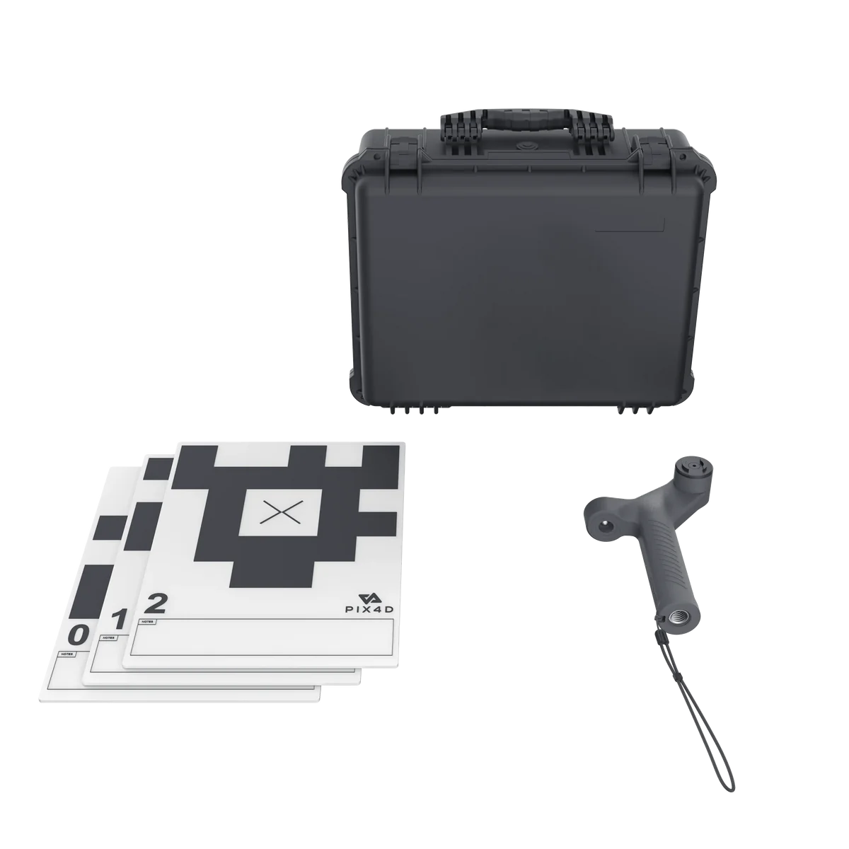
Emlid Scanning Kit Accessories
:
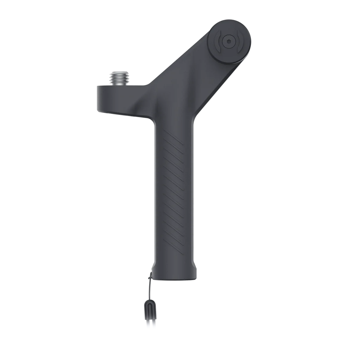
- 1x Emlid Handle (Polyamide 12, 200 x 119 x 36 mm)
- 1x Leash
- 1x Allen Key (3 mm)
- 5x Tags
- 1x Carrying Case (Plastic)
- SP Connect iPhone Case : Required to securely mount your smartphone.
Note: PIX4Dcatch app license must be purchased separately.
Key Features:
- RTK Precision : The Emlid Reach RX rover ensures survey-grade accuracy with real-time positioning, providing precise geotagging of captured data.
- Easy Integration : The PIX4Dcatch app works seamlessly with your mobile device, allowing users to create high-quality 3D models without needing specialized surveying skills.
- Multi-Industry Applications : Suitable for use in construction, infrastructure, mining, forestry, agriculture, environmental monitoring, and urban planning.
- Plug-and-Play : No complex setup or configuration required - just turn it on and start scanning.
How It Works:
- Capture Data : Use the PIX4Dcatch app on your smartphone to scan assets, infrastructure, or environments. The app leverages your phone's camera and LiDAR capabilities to collect high-quality data.
- RTK Positioning : The Reach RX rover provides precise, real-time positioning via NTRIP, ensuring all captured data is accurately geotagged.
- Generate Models : Process the collected data with the PIX4Dcatch app to create detailed 3D digital models.
- Collaborate and Share : Store and manage your models in PIX4Dcloud, annotate, measure, and share them easily with stakeholders.
Who Benefits from This Kit?
- Construction : Document trenches, as-builts, and perform volumetric measurements.
- Infrastructure Projects : Create accurate digital models for road, bridge, and utility construction.
- Mining : Capture and model mine sites, tunnels, and infrastructure.
- Forestry : Generate 3D models for forest management and health monitoring.
- Agriculture : Develop detailed 3D models of fields, monitor crop health, and optimize resources.
- Environmental Monitoring : Track changes in wetlands, wildlife habitats, and water quality.
- Urban Planning : Create precise 3D models of city buildings, infrastructure, and public spaces.
Benefits:
- Increased Efficiency : Streamline your data capture and processing workflow with a fully integrated solution.
- Enhanced Accuracy : Achieve precise geotagging with RTK positioning from the Reach RX rover.
- Simplified Sharing : Easily share processed data with stakeholders to facilitate better collaboration and decision-making.
- Cost-Effective : Reduce the need for specialized equipment and training with this easy-to-use, comprehensive kit.
Note : To use the full capabilities of this kit, an Apple iPhone Pro (with LiDAR), an SP Connect iPhone Case , and a PIX4D software license are required. For purchasing the full solution, including additional software options, check our store for the Emlid Pix4D Scanning Kits - Standard and Advanced versions.