


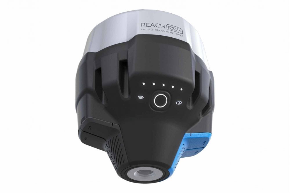


Product Details
Professional Multi-Band RTK GNSS Receiver for Centimeter-Level Accuracy
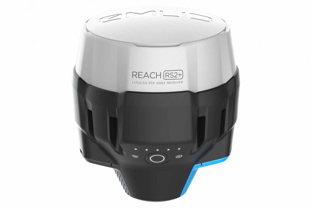
The Emlid Reach RS2+ is a professional-grade RTK GNSS receiver designed for surveyors, drone pilots, and mapping professionals who demand precision. With multi-band support and advanced positioning technology, achieve centimeter-level accuracy in challenging environments.
Key Benefits:
- Centimeter-level precision - Multi-band GNSS tracking (GPS, GLONASS, Galileo, BeiDou, QZSS)
- Fast convergence times - Get accurate positions quickly, even in difficult conditions
- RTK & PPK support - Real-time or post-processed kinematic workflows
- Rugged & reliable - Built for field work with IP67 rating and long battery life
- Easy integration - Works seamlessly with drones, rovers, and survey equipment
Perfect For:
- Land surveying and cadastral mapping
- Construction site layout and monitoring
- UAV photogrammetry and drone mapping
- GIS data collection and precision agriculture
Trusted by professionals worldwide, the Reach RS2+ combines cutting-edge GNSS technology with user-friendly operation. Whether you're establishing control points or collecting field data, this receiver delivers the accuracy and reliability you need.
Unleash Your Precision Power with the Reach RS2+ Multiband GNSS Receiver
Are you a dedicated surveyor, perpetually pining for that perfectly precise point? We've got you covered. Reach RS2+ is no ordinary GNSS receiver. It's a turbo-charged, precision-engineered, multi-frequency rocket of a receiver that's about to make your surveying life so much easier. And dare we say it? Even a bit more fun.
Ever felt trapped on those narrow city streets, tangled in dense forests, or jammed too close to buildings and machinery? Ever wished for a receiver that could cut through all that noise and deliver your data with centimeter precision? Reach RS2+ is the David to the Goliath of your surveying challenges. This sprightly solution integrates multiple frequency bands, ensuring that you can get a fix ten times faster and work on longer baselines. And did we mention it's affordable too? Because we believe every surveyor should have access to top-notch tech.
Now for the fun part. Reach RS2+ is a feature-rich beast, and it doesn't disappoint.
Key Features
- Lightning Fast: Get your fix in seconds, no more dilly-dallying.
- Multiband GNSS: Supports GPS/QZSS, GLONASS L1, L2; BeiDou B1, B2; Galileo E1, E5. Because why should you limit yourself?
- Long Range Radio: Integrated LoRa 868.915Mhz, ready to reach up to 8km. Talk about stretching your legs!
- PPP Support: The world is your playground with PPP processing.
- Built-in LTE Modem: For those times when your phone's internet just won't do.
- Battery for Days: Up to 22 hours on one charge. No need to carry spare batteries, unless you're preparing for a zombie apocalypse.
- Connectivity Galore: WiFi, Bluetooth, and LTE - the trifecta of modern connectivity.
- Built Tough: IP67 waterproof, extremely durable, and ready for any climate. This receiver can take a beating and keep on ticking.
- Storage for Days: With 16GB of storage, log for over 160 days at 1Hz. Just in case you feel like a marathon.
- ReachView 3 App Support: Record and stake out points with ease, available for Android and iOS.
Reach RS2+ is more than just a GNSS receiver; it's your dedicated surveying sidekick, ready to take on any challenge with you. From the coldest winters to the hottest summers, this durable, waterproof, and easy-to-use system will make your job faster, more efficient, and let's face it, more enjoyable.
So, dear surveyor, whether you're tackling the wilds of the countryside or navigating the concrete jungle, let the Reach RS2+ be your guide. Your search for the perfect GNSS receiver , RTK surveying equipment , precise positioning tool , or PPP GNSS receiver ends here!
Remember, two receivers can make magic happen with centimeter precision. So why not get a pair and start dominating the surveying world today?
Specifications

Gets fix in seconds
Reach RS2+ gets a fixed solution in just seconds and maintains robust performance even in challenging conditions. Centimeter accuracy can be achieved on distances up to 60 km in RTK, and 100 km in PPK mode.
GPS, GLONASS, BeiDou,Galileo, and QZSS
L1OF, L2OF, L1C/A, L2C,E1B/C, E5b, B1I B2I
PPP support
RINEX raw data logs are compatible with PPP services so you can now get centimeter-precise results in any place on Earth. Process RINEX files in an online service and get position with absolute accuracy.
Built-in LTE modem
Reach RS2+ features a power-efficient LTE modem with global coverage. Now corrections can be accessed or broadcasted over NTRIP independently, without relying on an Internet connection on your phone.
22 hours on 1 charge
Up to 22 hours of autonomous work when logging data and up to 16 hours as a LTE rover, even in cold weather—no more need to carry spare batteries with you. Reach RS2+ can charge from a USB wall charger or a power bank over USB-C.

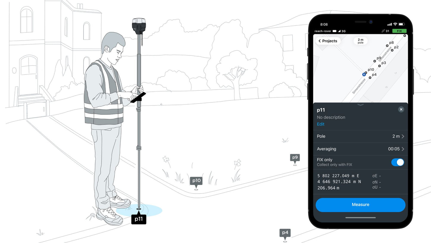
Surveying with ReachView
With ReachView 3, you can collect and stake out points and control all the features of Reach receivers, such as setting up a base station, logging RINEX data, and configuring NMEA output.The app is available both for Android and iOS, and supports thousands of coordinate systems and is translated into multiple languages.

Point collection: create projects, save points, and export in industry standard formats
Record each position as a point with centimeter precise coordinates. Export projects and open them in GIS or CAD software like AutoCAD, ArcGIS, QGIS, and others.
Formats: WGS84, NAD83, GDA2020, and others

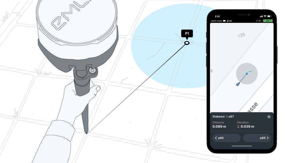
Stakeout: Find points' position on the ground
Stakeout is used to find exact physical locations of points. They can be collected in ReachView 3 or imported from other CAD or GIS software.
Logging in RINEX: record raw data, position, and base correction logs
Record raw data, position and base correction logs. Point collection and recording of RAW data are independent processes and can be used simultaneously. ReachView 3 has a simple and intuitive interface for logging configuration and control.
Emlid provide their version of RTKLib for PPK. It's free and can be downloaded from our docs.
16GB of storage allows for 160+ days of logging at 1 Hz
PPP for Opus
RINEX raw data logs are compatible with PPP services so you can now get centimeter-precise results in any place on Earth. Process RINEX files in an online service and get position with absolute accuracy.
Connectivity
Real-time position: streaming in NMEA
Reach provides data in standard NMEA that is used by most GIS apps. Simply connect your device to Reach over Bluetooth or with a cable, and turn on "Position output" in ReachView.
Compatible Apps: FieldGenius for Android, ESRI Collector, QField
Reach can turn on and off automatically
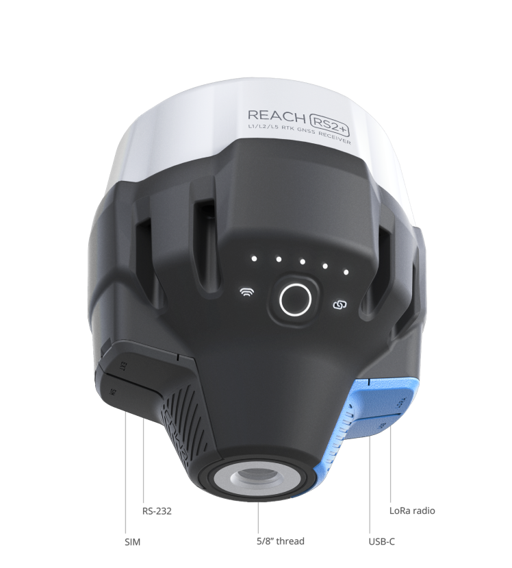
Reach is able turn on and off in sync with an external battery connected over RS-232. This helps when the power button is hard to reach. For example, if the receiver is placed on the roof of a tractor.
Position streaming Interfaces
RS-232, TCP, Bluetooth
NTRIP or another Reach as a base station
Reach RS2+ needs a base station as a source of corrections. That's a requirement for centimeter accuracy in RTK and PPK. Base might be either another Reach RS2+ receiver or an NTRIP service. VRS is also supported.
Reach RS2+ works seamlessly with other Reach receivers over any link.
Input and output corrections
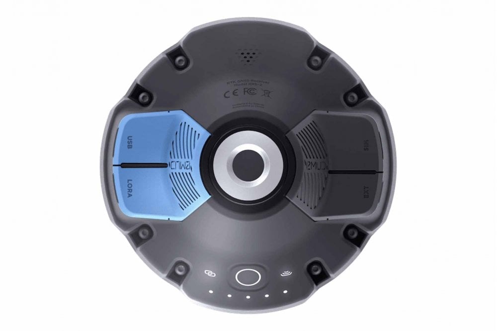
Interfaces
TCP, LoRa, Bluetooth, RS-232, NTRIP
Formats
RTCM3
Max distance from a base
Over 60 km in RTK 100 km in PPK Any place on Earth with PPP

Engineered to be tough
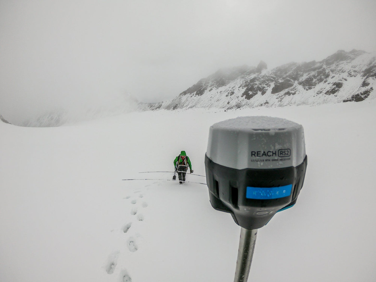
Reach RS2+ is designed to work even in the most challenging environments.
IP67: RS2+ is waterproof up to 1 m depth. All connectors are completely sealed and protected from water and dust with silicone plugs.
-20ºС...+65ºС: We extensively tested Reach RS2+ in conditions that simulate coldest winters and hottest summers.
Polycarbonate body: Polycarbonate, an extremely durable material that is used in bulletproof glass, makes Reach RS2+ impact-resistant.
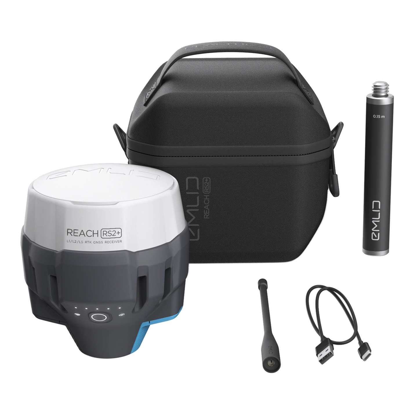
Package includes
- Reach RS2+
- Carry case with a strap
- Radio antenna
- USB-C cable
Two receivers are required for centimeter precision
Single Reach RS2 can provide centimeter accuracy as well, but it needs NTRIP connection.
Connectivity
-
LoRa radio
- Frequency range 868/915 MHz
- Power 0.1 W
- Distance Up to 8 km
-
LTE modem
- Regions Global
- Bands FDD-LTE: 1, 2, 3, 4, 5, 7, 8, 12, 13, 18, 19, 20, 26, 28, 66 TD-LTE: 38, 40, 41 UMTS (WCDMA/FDD): 1, 3, 2, 4, 5, 6, 8, 19 Quad-Band, 850/1900, 900/1800 MHz
- SIM card Nano-SIM
- Wi-Fi 802.11 b/g/n
- Bluetooth 4.0/2.1 EDR
- Ports RS-232, USB Type-C